Improving Satellite-Based Monitoring of Harmful Algal Blooms in Prairie Pothole Lakes Using Machine Learning
Freshwater lakes throughout the Prairie Pothole Region provide important ecological, recreational, and economic benefits but are increasingly threatened by harmful algal blooms (HABs). These blooms can degrade water quality, disrupt aquatic ecosystems, and produce toxins that pose risks to both humans and wildlife. Traditional monitoring methods rely on field sampling, which provides accurate measurements but is labor-intensive, costly, and limited in spatial and temporal coverage. Satellite remote sensing offers a promising alternative by enabling frequent, large-scale monitoring of lake water quality.
This research aims to improve satellite-based estimation of chlorophyll-a and phycocyanin, two key indicators of algal biomass and cyanobacterial blooms, using machine learning techniques. The study focuses on four lakes in northeastern North Dakota, Devils Lake, Stump Lake, Larimore Dam, and Homme Dam. Field water quality measurements collected during the growing season will be paired with Harmonized Landsat-Sentinel (HLS) imagery. Satellite imagery and environmental datasets will be processed and analyzed within Google Earth Engine. Published spectral indices will then be evaluated and incorporated into machine learning models to identify the most accurate methods for estimating chlorophyll-a and phycocyanin concentrations.
In addition to satellite observations, environmental variables such as water, temperature, wind speed, precipitation, and seasonal conditions will be incorporated into the models to determine whether they improve prediction accuracy. Explainable artificial intelligence methods will also be used to identify the environmental factors that most strongly influence model performance, providing greater insight into the processes that drive HABs.
This research seeks to develop a more accurate and transferable framework for monitoring HABs in inland lakes. The results will improve our ability to detect and monitor changes in water quality while providing lake managers and resource agencies with enhanced tools to support water resource management and protect freshwater ecosystems throughout North Dakota and other regions with similar lake systems.
Figures
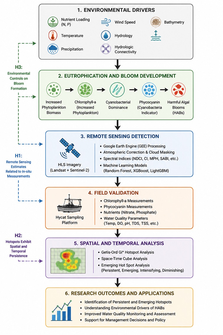
Figure 1. Conceptual framework illustrating the relationships among environmental drivers, harmful algal bloom development, remote sensing observations, field validation, and spatial-temporal hotspot analysis used to evaluate chlorophyll-a, phycocyanin, and nutrient dynamics within lakes of the Prairie Pothole Region. The figure was generated using artificial intelligence (AI) and subsequently reviewed and modified by the author.
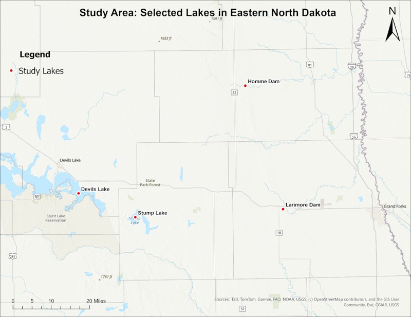
Figure 2. Location of the four study lakes (Devils Lake, Stump Lake, Larimore Dam, and Homme Dam) within eastern North Dakota.