Glaciology and Water Resources
Mountain glaciers are important water resources for the surrounding ecosystem, as well as for irrigation, fisheries, and drinking water for downstream communities. Changing environmental conditions, such as air temperature increases and decreases in winter snowfall, can quickly and significantly impact the viability of the glaciers. As the glaciers eventually melt away, the ecosystem and communities which rely on the meltwater will be altered. This research uses both field techniques and remote sensing to analyze glaciers around the world in an effort to understand 1) how rapidly the glaciers are changing, 2) the primary causes of the glacial changes, and 3) the impact of glacial meltwater on streamflow, ecosystems, and downstream communities.
UND Faculty Researchers: Jeff VanLooy
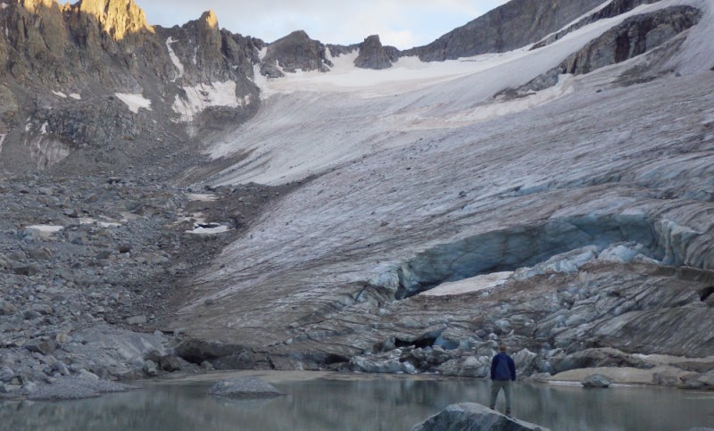
Jeff VanLooy standing in front of Knife Point Glacier in the Wind River Range, Wyoming in 2015.
Measuring Glacial Meltwater Contributions to Streamflow in the Wind River Range, Wyoming, USA
Much of Dr. VanLooy's research has focused on the glaciers of the Wind River Range in west-central Wyoming. These are the largest glaciers in the Rocky Mountains within the contiguous United States, and are an important supplemental water resource for the surrounding region, particularly during the late summer season after most of the previous winters' snowpack has melted. Dr. VanLooy has led small research teams consisting largely of graduate students to collect glacier ice surface elevation data using GPS, streamflow data using flow meters and pressure transducers, and water samples for stable isotope and water quality analysis. As well, remote sensing analysis has been conducted in the lab to calculate glacial melt rates using Digital Elevation Models (DEMs), and Landsat satellite imagery has been used to determine how albedo (the amount of energy reflected or absorbed by a material) may be changing on glacial surfaces, which in turn impacts the glacial melt rates.
Recent results of the glacial conditions in the Wind River Range over the last few decades indicate that the glaciers are steadily melting at a rate of 0.8 meters per year on average, and contributing as much as 30% to 50% to their respective watersheds during mid-August after much of the previous winter snowpack has melted away (VanLooy and Vandeberg 2019; VanLooy and Vandeberg 2024). Interestingly, a decline in glacier surface albedo (meaning more dirt, ash, etc. which absorbs more Sun energy) since the mid-1980s may be a significant factor in the glacial melting, as average summer temperature and winter snowfall have not changed much during this time (Owusu-Amponsah et al. 2023).
Contact: Jeff VanLooy
Publications
- Jeffrey A. VanLooy & Gregory S. Vandeberg (2019) Late summer glacial meltwater contributions to Bull Lake Creek stream flow and water quality, Wind River Range, Wyoming, USA, Physical Geography, 40:5, 461-480, DOI: 10.1080/02723646.2019.1565215
- Nana Y. Owusu-Amponsah, Jeffrey A. VanLooy & Gregory S. Vandeberg (2023) Changes in snow and ice surface albedo and its impact on snow and ice area in the Wind River Range, Wyoming, USA, Physical Geography, 44:5, 581-599, DOI: 10.1080/02723646.2022.2136594
- Jeffrey A. VanLooy & Gregory S. Vandeberg (2024) Glacier Meltwater Impacts to Late Summer Flow and Geochemistry of Tributaries in the Wind River Range, Wyoming, USA, The Professional Geographer, 76:5, 683-689, DOI: 10.1080/00330124.2024.2341073
Media
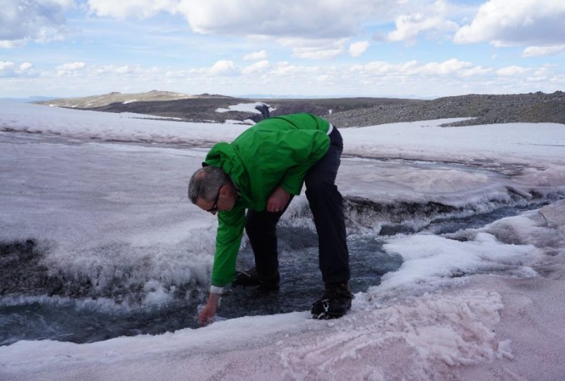
Jeff VanLooy collecting water samples for stable isotope analysis on Continental Glacier in the Wind River Range, Wyoming in 2019.
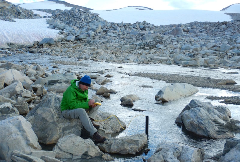
Jeff VanLooy setting up a pressure transducer to measure streamflow along the Continental Glacier outlet stream in the Wind River Range, Wyoming in 2019.
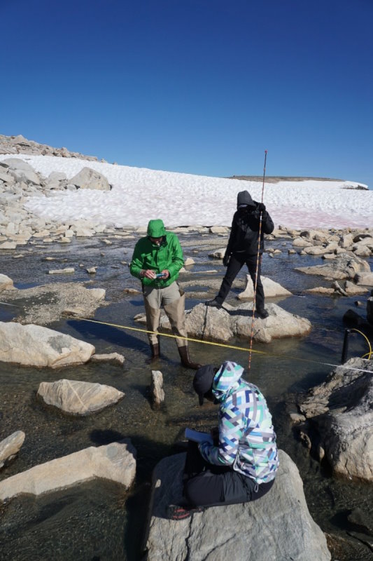
Jeff VanLooy (left) along with ESSP graduate students, Nana Owusu-Amponsah (top) and Anai Caparo Bellido (bottom), collecting streamflow measurements at the Continental Glacier outlet stream in 2019.
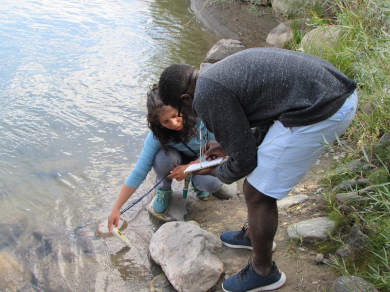
ESSP graduate students, Anai Caparo Bellido and Nana Owusu-Amponsah collecting water quality measurements along the Wind River, Wyoming in 2019.